
By Alex Bean, Source: Scuba Diving
Most everyone has heard of Google Maps, and many have used its “Street View” for navigation and directions, which allows the viewer to explore locations as if they were really there. But did you know that Google also offers “Street View Oceans” of underwater locations?
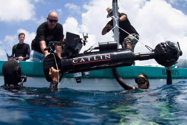
In an effort to document the Great Barrier Reef coral population off the coast of Australia, Google teamed up with the Catlin Seaview Survey to record underwater locations in 360-degree panoramic vision. The project’s mission is to get a baseline record of the world’s coral reefs in high-resolution imagery, while helping scientists monitor coral population changes over time. The end result is quite a success, with around 90 miles of reef surveyed and 150,000 GPS-located images available for marine scientists to study.
Due to the success of the initial survey of the Great Barrier Reef in 2012, the program is now global, branching out to various other locations around the world. The team’s focus was on coral reefs in the Caribbean and Bermuda in 2013 and the South-East Asian waters in 2014. Notable locations around the world also include the Galapagos Islands, the Underwater Museum of Isla Mujeres, Florida Keys Coral Restoration and the Yongala Shipwreck World Heritage Marine Site.
Read the rest at: Scuba Diving
0 Comments
Leave A Comment